Adelaide, the capital of the colony of South Australia, is situated on the Torrens, 7 miles SE. of Port Adelaide, on St Vincent Gulf, with which it is connected by railway. Adelaide stands on a large plain, and is walled in on the eastern and southern sides by the Mount Lofty range; the town proper is inclosed by a wide belt of garden and shrubbery. The first settlement was made in 1836, and named after the queen of William IV. The Torrens divides the town into North and South Adelaide, the former being occupied chiefly with residences, and the latter forming the business portion of the town. Four substantial iron bridges span the bed of the Torrens, which has been formed by a dam into a lake miles long. The streets are broad and regularly laid out, especially in Adelaide proper, to the south of the river, where they cross each other at right angles, and are planted with trees. Among the public buildings are the new parliament houses, erected at a cost of about £100,000; government offices, post-office, and town-hall; South Australian Institute, with museum, library, and art-galleries; and hospital. The botanical garden, with the botanical garden park, covers more than 120 acres of ground.
Adelaide is abundantly supplied with water from reservoirs several miles distant. The chief manufactures are woollen, leather, iron, and earthenware goods; but the chief importance of Adelaide depends on its being the great emporium for South Australia. Wool, wine, wheat, flour, and copper ore are the staple articles of export. Among educational institutions the most important are the Adelaide University; St Peter's (Episcopal) College; St Barnabas Theological College, opened in 1881; and Prince Alfred (Wesleyan) College. It is the seat of an Anglican and of a Roman Catholic bishop. Adelaide has telegraphic communication with the other colonies, and is the terminus of the direct line to London, via Port Darwin. Glenelg on the sea, 5 miles away, is a favourite watering-place.
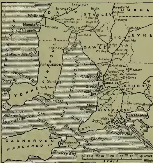
Pop. (1871) 27,208; (1881) exclusive of suburbs, 38,479; (1891) 37,837, or including the extensive suburbs, 133,252.—PORT ADELAIDE, its haven, dates from 1840, is situated on an estuary of the Gulf of St Vincent, has a safe and commodious harbour, and an ocean dock capable of admitting ships of the largest size. It is a principal port of call for vessels arriving from Europe either round the Cape or by the Suez Canal; and since 1887 railway communication has been established between Adelaide, Melbourne, Sydney, and Brisbane. Passengers and mails for all parts of Australia can accordingly be landed here. Two forts have been erected for the defence of the port. Tramways were introduced in 1878. Municipal pop. (1891) 5013.