Cadastral Maps

Chambers's Encyclopaedia, Volume 2: Beaugency to Cataract, p. 612
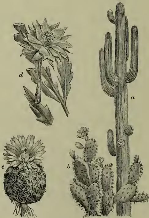
Four detailed botanical illustrations of cacti. (a) shows a large, spiny, pineapple-shaped cactus (Cereus giganteus). (b) shows a cactus with flat, paddle-shaped segments (Opuntia coccinellifera). (c) shows a smaller, more rounded cactus (Mammillaria pectinata). (d) shows a tall, columnar cactus with several arms (Phyllocactus anguliger).
Four detailed botanical illustrations of cacti. (a) shows a large, spiny, pineapple-shaped cactus (Cereus giganteus). (b) shows a cactus with flat, paddle-shaped segments (Opuntia coccinellifera). (c) shows a smaller, more rounded cactus (Mammillaria pectinata). (d) shows a tall, columnar cactus with several arms (Phyllocactus anguliger). a , Cereus giganteus ; b , Opuntia coccinellifera ; c , Mammillaria pectinata ; d , Phyllocactus anguliger .

Cadastral Maps are maps on a large and complete scale. Properly a cadastral survey is made by the government for fiscal purposes; the word being derived through the French from Ital. catastro, which is from the low Lat. capitastrum, 'a register for a poll-tax' (Lat. caput, 'the head'). See ORDNANCE SURVEY. of the series. This reduction of the vegetative system, as might be expected, is usually accompanied by a reduction of size. Some grow rapidly on old lavas, and disintegrate them by their penetrating roots, so preparing a soil for other plants; the prickly pear is often planted in Sicily by the mere insertion of a joint of it in a fissure of the lava. Many species are Epiphytes (q.v.) in American forests (e.g. Rhipsalis); others range

Source scan(s): p. 0625