Clouds are masses of fog, consisting of minute particles of water, often in a frozen state, floating in the atmosphere. When air has its temperature lowered below the saturation point, either by ascending and becoming rarer, or by meeting a colder current, a portion of the vapour loses its gaseous form, and becomes condensed into minute specks of water. It has been shown by Dr Aitken that this condensation always takes place round a small particle of dust. A cloud, therefore, does not consist of vapour, in the proper sense of the word, but of very small drops of water. How this water-dust is suspended in the atmosphere—why the particles do not descend as soon as formed, has never been thoroughly explained. Professor G. G. Stokes holds that the rate of fall is rendered exceedingly slow by the friction and drag of the air-particles, just as fine powders remain suspended for a long time in liquids of much less specific gravity than themselves. Besides, as Sir J. Herschel says, ascending air-currents also oppose the fall of clouds, for the air may be ascending faster than the particles of the cloud are falling through it; while at night, in the absence of rising currents, clouds often descend to, and dissolve in lower and warmer levels. The conditions under which clouds are formed, and afterwards deposited in rain, are more fully considered under EVAPORATION, DEW, RAIN, SNOW-LINE. The present article is confined to a description of the various kinds of clouds and of the weather they indicate.
A general haze of precipitated vapour covering the sky, and coming down to the earth, is termed a Fog or Mist; and the term cloud is usually confined to masses of fog floating in the higher regions, and not descending to the ground. They are mostly within a mile of the earth's surface; and few are more than six miles above it. From observations made at Upsala in Sweden, it has been found that there are three principal cloud layers: the low clouds at from 2000 to 6000 feet; middle clouds, 12,000 to 15,000 feet; and high clouds, 20,000 to 27,000 feet. These three layers are found at apparently much the same heights all over the earth. Clouds spread and move with the wind in varied, often grand forms; they are generally disposed in beds parallel to the earth's surface; vertical clouds occur rarely, if at all.
Mr Luke Howard's classification of clouds, proposed in 1802, into three primary forms—Cirrus (Cir.), Cumulus (Cum.), and Stratus (Str.); three intermediate—Cirro-cumulus (Cir.-c.), Cirro-stratus (Cir.-s.), and Cumulo-stratus (Cum.-s.); and one compound form, Nimbus (Nim.)—has been universally adopted, and has been shown by the Hon. Ralph Abercromby and others to hold good in all climates and atmospheric conditions.
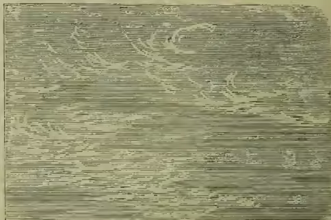
Cirrus, or curl cloud, consists of parallel, curling, flexuous, diverging, and partly straight fibres, increasing in any or in all directions by elongation, branching, or addition of new fibres. It is the highest and least dense of clouds; varies most in extent, direction, and shape; retains longest its varied outlines; and is the longest illuminated after sunset and before sunrise. It has been compared to a mare's or cat's tail, a lock of hair, fine trellis-work, or thin silvery streaks, and it may cover all the sky. Threads and groups of Cir., during gentle wind after severe weather, presage serene settled weather. But after a long tract of fair days, whitish filaments or parallel bands of Cir. crossing the sky, with the ends converging by perspective in each horizon, foretell a change to wet; they move with the upper currents of the atmosphere, and generally indicate by this motion a change of wind long before it is felt on the earth's surface. Cir., being so high, consists of minute ice crystals, whose refractions and reflections produce the halos, coronæ, and mock suns and moons almost restricted to this cloud and its derivatives the Cir.-s. and Cir.-c. Cir., especially with fine tails, varying much in a few hours, presages rain or snow, and windy variable weather.
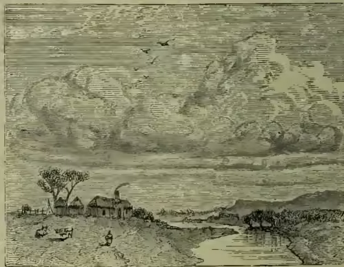
Cumulus, ball of cotton, day or summer cloud, consists of dense, convex, hemispherical, or conical heaps of small roundish clouds, piled or stacked on each other. The heaps enlarge upwards from a horizontal base, and have rounded or rocky tops; they sometimes unite into stupendous white-topped mountains. It is formed by the condensation of vapour in local ascending columns of air, and is generally at from 4000 to 6000 feet elevation. Cumuli often begin after sunrise as a few scattered specks in the clear sky; these specks enlarge and unite to form clouds, which nearly cover the sky in the afternoon, and generally decrease and vanish about sunset; but rain follows if they increase in number and darkness in the evening. Cum., of pleasing forms, dispositions, and colours, and of moderate size, presages fine dry warm and calm days; but cold, rain, and tempest follow dark, abrupt, dense, shaggy Cum., covering the sky, and rolling on each other. Hemispherical, silvery white Cum. presages thunder.
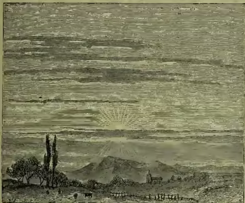
Stratus, fall or night-cloud, the lowest of clouds, is a widely extended, horizontal sheet, of varied thickness, seldom rising above 4000 feet, and often quite close to the earth's surface. It is common in summer and autumn, often from sunset to sunrise, and is densest at or after midnight. It arises in calm clear evenings, after warm days, from the sinking and flattening out of Cum., from the cooling of moist air on damp ground, marshes, lakes, rivers, or from the cooling of moist air mixed with smoke enveloping great cities. From a height it is seen spreading around like a sea, and creeping up hillsides. After sunrise it rises higher, sometimes forming Cum., and sometimes entirely disappearing; but it may quietly accumulate in layers, and become Nim.
Cirro-cumulus, or sonder-cloud, consists of Cir. compressed into dense roundish-white cloudlets, or woolly irregular tufts, and is found either in the middle or high cloud layers. It forms the well-known mackerel sky, but is also often seen through breaks in lower clouds moving differently. It may vanish or pass into Cir. or Cir.-s. Solar and lunar coronæ appear in it. It occurs in warm dry weather and between summer showers, and presages increased heat. Cir.-c. very dense, round, and close, and with Cum.-s., presages a storm or thunder. In winter it precedes a thaw and warm wet weather.
Cirro-stratus, or vane-cloud, consists of long, thin, horizontal clouds, sometimes hairy, with bent or undulated edges. It is found on the advancing side of cyclonic storms, and hence is a sure prognostic of wind or rain. Being of great extent, but little depth, and at a great height, it is the most usual source of solar and lunar halos.
Cumulo-stratus, or twain-cloud, is a Cir.-s. mixed with Cum. heaps, or a wide flat base surmounted by a bulky Cum., with fleecy protuberances or rocky and mountain masses. It is much denser than Cum., though being formed by less rapidly ascending currents, the air is not dry enough to round off sharply its tops. It often forms vast banks of cloud, with overhanging masses. It is common towards night in dry windy weather, when it has a leaden hue. It generally arises from Cum. becoming denser, wider, and protruding in large irregular projections over the base. It tends to overspread the sky, and partly or wholly to become Nim., and fall in showers. Cum.-s. is intermediate between clouds indicating fair and those indicating rough, rainy weather, and attends sudden atmospheric changes. Distinct Cum.-s. forms before thunder. Cum.-s. increases the grandeur of mountain scenery, and drops on and envelops mountaintops like a curtain.
Nimbus, or Cumulo-cirro-stratus, the black rain-cloud, is a cloud, or mixed system of clouds, with rain or snow falling from it. It is a dense, continuous, horizontal black or gray sheet, with fringed edges, having rolling masses of Cum. above it and topped by Cir. Before rain, vast towering masses of Cum. often pass into Cum.-s., which, increasing in density, darkness, irregularity, and extent, become Nim. capped by Cir.-s. Thunderstorms are always accompanied by Nim. in its most perfect form.
The term scud has been applied to loose vapour fragments of clouds driven by wind, and cumulonus to very shaggy cumuli.
The formation and height of clouds depend on the quantity of vapour in the air, the course and height of air-currents, the climate, season, temperature, disposition, and extent of sea and land, and the height of land. The highest clouds yet observed were Cir. at 43,800 feet elevation. Remarkable cloud-rings prevail over the calm zones of the equator, and over those of Cancer and Capricorn. The tops of mountains are often capped by clouds formed by the moisture in the air condensing as it is forced up and over the hill. Clouds, viewed from above in bright sunshine by the aeronaut or mountaineer, appear as dense volumes of steam or masses of white cotton.
Clouds moderate the sun's rays during day, and the earth's radiation during night. They always exhibit positive or negative electricity, but of greatest tension in thunderstorms. They are the carriers of the moisture required by plants; of the water of springs, lakes, and rivers; and of the polar, glacial, and winter snows, which cover temporarily or permanently parts of the earth.
In Britain, six or seven tenths of the sky is on an average daily obscured by clouds. There is most cloud in winter, and about mid-day, and least in May or June, and during night. Summer and autumn nights are freest of clouds. All the forms of clouds may be seen in one day, often very much commingled.