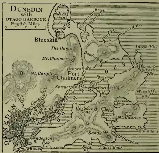
Dunedin, capital of the provincial district of Otago, and the most important commercial city in New Zealand, is situated at the head of Otago Harbour, on the east side of South Island, towards its southern extremity. It is 190 miles by sea from Lyttelton, and 150 miles from Invercargill, and 139 by rail. Since its foundation by an association of members of the Free Church of Scotland in 1848, the city has rapidly increased in importance; chiefly after the year 1861, when the discovery of extensive gold-fields in the neighbourhood caused a sudden increase of population. Dunedin, which is the seat of the supreme court, and of a resident minister, is divided into four wards, and municipal business is conducted by a mayor and twelve councillors. It is as well laid out as the hilly nature of its site will allow; it is well paved, lighted with gas, and supplied with water from the Water of Leith valley and the Silverstream. Dunedin is the seat of an Anglican and a Roman Catholic bishop. There are many handsome churches and buildings; the new Bank of New Zealand, completed in 1882, is one of the finest in the city. Other edifices are the post-office, hospital, government buildings, mechanics' institute, lunatic asylum, &c.; and the inhabitants of the city possess places of recreation in the Botanical Gardens and the grounds of the Acclimatisation Society. The theatre, burned down in 1875, has been rebuilt. There is a carriage-drive through the reserve called the Town Belt, which encircles the city, and a fine racecourse, near Ocean Beach, 2 miles distant. The high school and the university, which is affiliated with that of New Zealand, are flourishing institutions. There are several daily papers, and numerous weeklies and monthlies. Woollens are manufactured. The street tramways are on the horse and cable system. Railways connect Dunedin with Christchurch to the north and Invercargill to the south. Dunedin has frequent communication with the other colonial ports, with Melbourne and the home country; and since the opening and deepening of the new Victoria Channel from Port Chalmers, large steamers can approach the wharf. For purposes of defence, two batteries have been erected on the headlands at Ocean Beach, and a third on Otago Heads. The city was originally to have been named New Edinburgh, but by a happy suggestion of Dr William Chambers of Edinburgh, its name was changed to Dunedin, the Celtic designation of the Scottish capital. Pop. of the city proper (1871) 14,857; (1881) 24,372; (1891) 22,376; with suburbs, which largely consist of adjacent boroughs, 45,869.