Glaciers are rivers of snow compacted by pressure into ice, which move slowly from higher to lower levels. In tropical and temperate climates glaciers are found only upon the higher parts of lofty mountains, but at the poles whole continents and great islands are entirely or partially covered by them.
Distribution.—Their distribution is very extensive: they occur in Greenland, which is almost an entire sheet of ice; on the islands between Greenland and North America; in North America towards the centre, in Alaska and dotted along the Pacific coast, and continued down to the extremity of South America; in Europe, in Norway, among the Pyrenees, and along the Alps; in Asia they pervade the Himalayan system, and appear in Japan and on the opposite mainland. The unexplored Antarctic continent is, to all appearance, covered entirely by one great ice-sheet of over 10,000 feet in thickness. Traces of their presence in past geological ages are even more general, appearing as they do over the larger part of North America, the southern portion of South America, all northern Europe, as well as smaller areas in Africa, Australia, New Zealand, &c. Of the 1155 glaciers of the Alps, the longest is the Aletsch, 15 miles in length; the depth of the Aar glacier has been estimated at 1510 feet. Next to the Aletsch among European glaciers is one in the Caucasus.
Position.—At and near the equator a height of 16,000 feet is necessary for the formation of glaciers, but, as cooler regions are approached, the required altitude becomes less and less, until the poles are reached, where the ice-sheets are presented emptying themselves into the ocean. But wherever occurring, they are always greatest and most frequent on eminences of the required height, which first meet the vapour-laden winds coming from the sea, and presenting a side or sides but little exposed to solar influences. Thus, the Himalayan Mountains, being directly in the track of the south-west monsoon, with no intervening heights of any consequence between them and the ocean, first receive its watery burden, with the consequent formation of the great glaciers of that region. In the same way the Andes of South America, meeting the breezes from the Pacific, bear great ice-sheets upon all their more prominent peaks. In New Zealand, while the glaciers of the Mount Cook range reach down to 700 feet above the sea on the west side, they reach only to 2000 feet on the east side.
Movement.—On the higher summits of glacier-bearing mountains the snow lies loose, in granular form and comparatively lightly; but, as it is impelled down the sides of the eminences by gravitation, the pressure of the masses from behind and from the sides gradually hardens and compacts it, until at last the air is driven out, and, the forces from above acting with greater power from increase of weight and impact, the glacier assumes its best-known form—that of a homogeneous concretion of blue, crystalline ice. Thus slowly pushed forward, the glacier continues to descend, until, in the warmer latitudes, a zone is reached where the sun becomes too powerful to be resisted, and the ice melts, thus forming the headwaters of rivers, many of which take their origin in this way. In more rigorous climates the ice-sheets are pushed down to the lowest-lying grounds, until their edges are protruded into the sea, and until a sufficient depth of water is reached to float the buoyant ice, which is now submerged to two-thirds of its thickness. Partly by the action of the swell, partly because of its own weight, the edge becomes detached from the parent mass, and floats out to sea in the form of Icebergs (q.v.). This process of dissolution is known among whalers as 'calving.' But even in the higher latitudes, such as Greenland, where the temperature is always exceedingly low, the ice dissolves and reaches the sea by rivers as well as by icebergs. The melting in such cases is almost entirely due to pressure, the water escaping from below the ice-sheet. The solar influences being weak, even in the height of summer the supply of moisture derived from the exposed surfaces in these regions is small and insignificant.
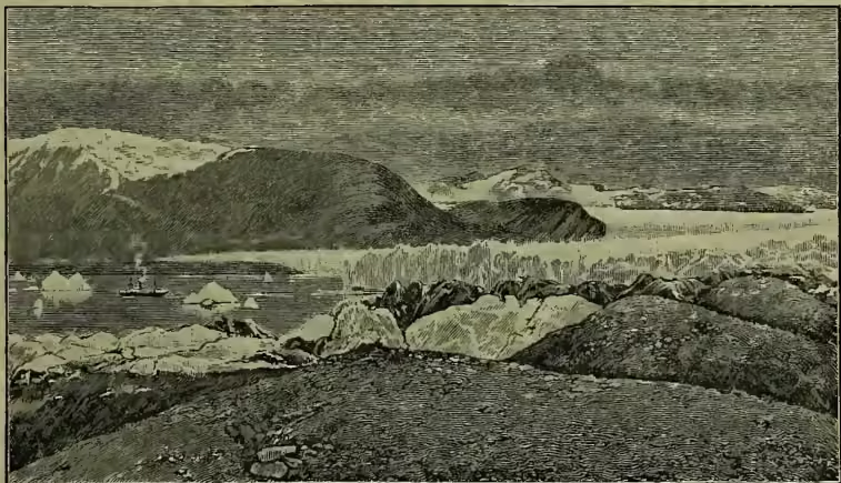
Although the onward movement of a glacier is too slow to be perceptible to the eye, it is none the less present and, generally, continuous. J. D. Forbes found (from measurements made by himself in the Mer de Glace, near Chamouni; see ALPS) and first proved that the whole sheet does not possess the same rate of motion, the centre advancing more rapidly than the sides. He discovered that in summer and in the fall of the year the middle of that glacier drew forward at a rate of from 1 foot 8 inches to 2 feet 3 inches, and at the sides at from 1 foot 1 inch to 1 foot 7½ inches per diem. Agassiz at about the same time carried on a series of independent experiments on the glacier of the Aar, and arrived at similar conclusions. Helland later on demonstrated that in Greenland a more rapid motion was to be found, and that the Jacobshavn glacier advanced at a rate of from 48·2 feet to 64·8 feet in the twenty-four hours. This result has lately been generally confirmed, although somewhat modified, by Dr Rink, who, from a considerable collection of data, concludes that the quickest rate of progress of the centres of the glaciers of that region averages 21 feet in twenty-four hours. In many areas in Greenland, however, the limits of the ice-sheets were found to be almost stationary, and prolonged and careful observations became necessary before any progress could be noted. In these cases the configuration of the ground was the principal cause of the more gentle motion. The variation in the rate of movement in different parts of the mass is analogous to that of rivers, and there are many other points of similarity between glaciers and streams of water which will call for notice below.
The above remarks broadly point out the general movements of glaciers, but various modifying agencies are frequently present, which change for a time the regularity of the motion. Thus, when slipping down a steep incline the rate of progress is much more rapid than when level tracts or rising ground are being traversed. The surface of the ice-sheet, too, travels with somewhat greater velocity than the lower strata, and the nature of the glacier's bed here again produces modifications. When the path is smooth and sloping, the rates of speed at which the upper and under portions advance are much more equal than when obstacles intervene, preventing the lower strata from keeping up an equal ratio of motion with the portions nearer to and at the surface. When the ice-sheet turns aside from following a straight course and forms a curve, the maximum of motion is no longer in the centre, but at points along the surface nearer to the convex side of the curve.
In temperate and tropical latitudes the exposed top of the glacier is being continually lowered and reduced by evaporation, and it would appear that, as a general rule, the ice masses in such situations lose more by this process than they gain from the snowfalls of winter. When a series of hot summers and mild winters succeed each other, the amount of ice dissolved and conveyed away in the form of running water exceeds considerably the supply brought down from higher levels by gravitation, and the glacier retreats up its bed or valley. On the contrary, when a succession of cold summers and severe winters are experienced, it pushes itself farther down, and appears, through these effects of the seasons, to possess a kind of elasticity.
When decided inequalities in the ground are passed over, the hollows become filled up with ice belonging to the bottom of the glacier, the superincumbent masses passing over them; in this manner 'ice eddies' are formed. On coming down a sharp declivity the glacier becomes much cracked and fissured, pinnacles and towers become conspicuous, and the whole fall presents a scene of chaotic confusion. No sooner, however, is comparatively level ground again reached than the pressure exerted by the flow from the heights once more asserts itself, and again cakes the shattered fragments into a smooth, solid whole. Crevasses are cracks in the ice-sheet, at first narrow, and of no great depth; but as the glacier progresses they increase in size, often assuming the dimensions of huge chasms, frequently reaching from the top to the bottom of the mass and travelling downwards with it, until some temporary stoppage in front presses the edges one against the other, and seals up the orifice.
It has been urged that, when glaciers flow over a level or rising surface, something more than the mere force of gravitation must be sought to account for their forward movement, and the theory has been advanced that water, percolating from the surface through openings into the body of the ice, and there undergoing expansion during the process of freezing, may be a powerful factor in impelling the glacier onwards, where gravitation alone could hardly be sufficient to account for its advance.
Work.—Glaciers have many features in common with rivers. Thus, they have regular drainage areas from which they draw their supplies; they move from higher to lower levels with more or less rapidity as the configuration of the ground varies; the whole mass does not move at the same rate; they carry along with them rocks, boulders, gravel, sand, and earth; they reach the ocean in the forms either of ice or water; and they convey to the sea their burdens of terrigenous materials. Their influence upon marine deposits would, in the present state of our knowledge, appear to be very great—greater, indeed, than that of the largest rivers discharging on a bold and little indented coast, and nearly as great as that of large rivers falling into bays and partially enclosed seas. Thus, the continental marine deposits off the shores of Antarctica extend almost as far out into the ocean as those brought down into the Bay of Bengal and Arabian Sea by the Ganges, Indus, and the other great streams of India, and to an infinitely greater extent than those conveyed by the great rivers of the smooth, east coast of Africa, which empty themselves directly into the open ocean.
The formation of moraines is one of the most evident phenomena connected with the work of glaciers. They are of three varieties, known as terminal, lateral, and median. A terminal moraine consists of a gathering of boulders, rubbish, &c., pushed down by the advancing ice-sheet and heaped up before it. When the glacier retreats, the moraine is seen to be of a crescent shape, the extremities pointing backwards and the centre pushed more or less forward—evidence of the greater rapidity of motion of the centre than of the sides of the glacier. Lateral moraines are formed by the denudation of the sides of the bed or valley down which the ice-sheet flows. In its forward movement it scrapes off immense quantities of rubbish from the sides, which, falling on the outer edges of the sheet, are carried forward and downward and thrown off laterally. When two glaciers meet, they coalesce and flow onward as one; the lateral moraines at the sides of juncture unite also, and form a medial moraine down the centre of the great trunk glacier. Boulders, so long as they are carried upon the ice-sheets, are in nowise changed by transport, preserving all their angularities and sharp corners. Many of them, however, fall into the crevasses, and, reaching the bottom, are ground and rasped along the rocky bed of the ice-stream. These boulders, as well as the solid rocks they are rubbed over, become polished and striated, and in this way evidence of the presence of glaciers is preserved long after they themselves have disappeared. The water discharged from the extremities of ice-fields is always muddy, heavily charged with a fine powder, produced by the scraping of rock and ice against rock and soil. In the warmer regions, when a glacier protrudes below the snow-line the amount of water melted from the surface is very considerable, often finding its way into a crevasse and uniting with the water already collected there, produced by the higher temperature prevailing in the lower strata of all glaciers, and resulting from the effects of pressure. The falling water in the course of time drives a shaft or tunnel through the ice at the bottom of the crevasse, and these shafts are known as moulins. The closing of the crevasse does not necessarily imply the destruction of the moulin, which often remains entire, with a deposit of rubbish, left by the water, all along the bottom, and may come to light again through the opening of a fresh chasm much farther down the glacier.
For particulars and discussions regarding glaciers and their work, see De Saussure's Voyage dans les Alpes; Agassiz' Etude sur les Glaciers; Crole's Climate and Time; Geikie's Great Ice Age; Forbes's Travels in the Alps; Tyndall's Glaciers of the Alps; Thomson, Proc. Roy. Soc., 1856-57; Scottish Geog. Mag., vol. v.; Heim, Handbuch der Gletscherkunde (1885); also Dr Frederick Wright's important work, The Ice Age in North America (New York and Lond. 1889). For the influence of glaciers on marine deposits, see maps by Dr John Murray in the Scottish Geog. Mag., vol. v.