Nile, the longest river of Africa, if not of the world, hydrographically, historically, and geographically a river of the greatest interest, and to the ancient Egyptians pre-eminently the sacred river, draws its largest supplies of water in the country of its sources from the Victoria and Albert Nyanzas. Several streams flow into the Victoria Nyanza, but which originates farthest to the south is not yet definitely known; the honour seems to lie between the Shimiyu and the Isanga. At any rate, the most distant feeders of the great river may probably be placed near to 4° S. lat. The river Kagera or Alexandra Nile, which joins the Victoria Nyanza high up on the west side, is believed to issue from Lake Alexandra, some 250 miles to the south-west; that stream brings a large volume of water to the lake. The Nile leaves Victoria Nyanza at its northern end, pouring over the Ripon Falls, 150 to 170 yards wide but only 12 feet high, and then for 300 miles races between high rocky walls, over rapids and cataracts, at first north-west, then west, until it joins Albert Nyanza near its north-east corner. About 20 miles from this lake the river leaps down 120 feet into a wild gorge, with high rocky walls. The section between the two Nyanzas is called the Victoria Nile or Somerset River. At its south-western extremity the Albert Nyanza is joined by the river Semliki, which drains away the surplus water of the Albert Edward Nyanza (discovered by Stanley in 1889); and this lake in its turn drains the slopes of the snowy Ruwenzori and adjacent mountains. The combined river leaves the northern extremity of the Albert Nyanza as the Bahr-el-Jebel, and from that point flows in a general northerly direction to the Mediterranean. The first 130 miles to Dufle it passes through a level country, and frequently expands into lakes. From Dufle to Lado (120 miles) the bed is contracted by rocky hills from a mile to a quarter of a mile in width; and the stream is forced over the Yarborah Rapids. At Lado ( N. lat.) the river enters the plains, and moves thence slowly and sluggishly down to Khartoum, 900 miles to the north. The whole of this stretch is navigable for river-steamers of fairly large size. In N. lat., however, the main channel divides; whilst the right arm, the Bahr-el-Zeraf, goes almost due north, the left arm, which still continues to be called the Bahr-el-Jebel, trends slightly to the west. Both streams flow through a low swampy region, during the rainy season inundated for miles wide. The banks are lined with tall reeds and papyrus, the abode of numerous aquatic birds and swarms of gnats and other insect plagues. Since the year 1863 both channels have been rendered wholly or in part impassable by vast accumulations of vegetable débris (sudd), but in 1900 it was being actively cleared out with a view to improving the navigation of the upper river. In N. lat. the Bahr-el-Jebel meets the Bahr-al-Ghazal, which, coming from the west, gives the united stream, now called the White Nile, an easterly course. Although this tributary, navigable for some 200 miles above the confluence, runs nearly dry in the dry season, it gathers to itself the contributions of a very large number of rivers, some of them 300 and 400 miles long, which have their sources to the south and south-west in the country of the Niam-Niam tribes; one only, the Bahr-al-Arab, comes from the northern side—from Darfur, to the north-west.
Sixty miles east of the confluence the White Nile receives the Bahr-el-Zeraf, and 30 miles farther east the navigable Sobat from the Galla country. Some 60 miles down-stream from the Sobat mouth is Fashoda, whose occupation by Marchand in 1898 threatened to lead to war between France and England. From Fashoda the White Nile flows almost directly north to
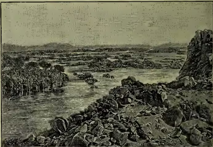
Khartoum without being augmented by a single tributary stream. At Khartoum (in N. lat.) the White Nile, or Bahr-al-Abiad, is joined from the south-east by the Blue Nile, the Bahr-al-Azrak, the water of the respective streams being of the colour indicated in the names. The Blue Nile, 950 miles long, gathers its volume principally from Lake Tzana (5658 feet above sea-level), situated on the Abyssinian plateau, in which region it is known as the Abai. It leaves the lake towards its southern end, and, after running south-east, curves right round by way of the south till it comes to flow north-west. After leaving the mountains it traverses an extremely fertile plain, the capital of which is Sennaar. From Khartoum the Nile flows north-north-east, and 200 miles below that city is joined from the right by the Atbara, called also the Bahr-al-Aswad, or Black Nile. It is the black sediment brought down by this river that settles in the Nile delta, and makes it so extraordinarily fertile. This affluent, too, has its source on the Abyssinian plateau, and its volume is increased by two large tributaries, the Takazze and Mareb, both striking into it from the right. During its course from the confluence of the Atbara through the Nubian Desert the great river makes two deep bends, first round by the north, then round by the south, and subsequently resumes its northerly flow. Below Khartoum navigation is rendered extremely dangerous by the cataracts which obstruct the bed of the river, the sixth occurring not far north of Khartoum, the first near Assouan, in Egypt, just above N. lat. The course of the river from Assouan to the sea is sufficiently described under Egypt (q.v.), where also a map of the entire course is sketched. The total length of the river cannot be stated precisely; from Victoria Nyanza it is estimated to measure 3400 miles. The Nile begins to rise at Gondokoro in April, the Bahr-al-Ghazal perhaps a week or two earlier. At Khartoum the rise begins in May, and reaches its maximum in September, whilst the Blue Nile rises from July to the third week in August (see NILOMETER). Irrigation is largely regulated by barrages at Rosetta and Damietta, constructed by French engineers in 1843-61, and practically reconstructed in 1886-90 at a cost of £405,000. A vast reservoir is to be made near Philæ (q.v.).
The ancients had little knowledge of the Nile above Meroe, between Berber and Khartoum. The place of accurate knowledge was taken by myth, to the effect that the river had its origin in Mauretania (now Morocco), and flowed several days' journey underground until it came to the south of Ethiopia; thence it passed northwards as the Astapus. The Emperor Nero began the fascinating work of searching for the sources of the Nile by sending two expeditions, which seem to have ascended beyond the confluence of the Sobat and White Nile. Ptolemy speaks of two streams issuing from two lakes 6 and 7 degrees south of the equator and uniting in N. lat., and being joined in N. lat. by the Astapus, which likewise flowed from a lake (Coloe). The two lakes in the far south were fed by the melting snows of a great range of mountains, the Mountains of the Moon (which Stanley now identifies with Ruwenzori, Gordon Bennett, and the adjoining peaks). This remained the sum total of information about the river down to the 19th century, except that in 1770 Bruce discovered that the Blue Nile issued from Lake Tana. The Egyptian government in the years 1839-42 sent three expeditions up the river, which got as far as Gondokoro. In 1858 Speke reached the Victoria Nyanza, and in 1862 discovered Ripon Falls. Two years later Sir Samuel Baker discovered Albert Nyanza, and in 1868-71 Schweinfurth explored the western feeders of the White Nile. Stanley, in 1875, sailed all round Victoria Nyanza, and in 1889 traced the course of the Semliki, and discovered Albert Edward Nyanza and Mount Ruwenzori.
See works of the explorers named, also others by Marno, Von Klöden, Wilson and Felkin, Schuver, Petherick, Junker, &c., with Walter Budge's The Nile: Notes for Travellers in Egypt (1890). For the battle of the Nile, see ABOUKIR.